|
|
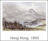
Latest additions - Philadelphia plan (SDUK), 1844 |
Royalty Free printable Stock Images of historical antique maps and prints
Each map or print has a thumbnail image linked to a larger screen resolution image, plus the maps have a small portion of detail at the full resolution, they are available to purchase for download at $5 (US) each for maps and $4 or $5 for prints. These could have many uses, such as book and magazine illustrations or covers, TV / film work (documentaries, historical productions etc.) and genealogical interests. Being very high resolution images (300-800 dpi) they are also of sufficient quality for reproduction as decorative giclee prints, using a suitable printer. (I use a high end Epson and have had excellent results.) With suitable image processing (see my Information page) they are capable of being printed at a larger size than the originals. Please review the information notes to the left, the high resolutions digital images of historical maps are very large and may need manipulation / resizing depending on their intended use. The detailed full resolution samples look slightly blurred on the screen, as mentioned above they can be sharpened if necessary. There are mainly maps and plans available at the moment, and some prints of China. More will be added when I find the time, along with more prints and views. Note - Payment for these historical map downloads is via PayPal |
|
The original items are no longer within copyright but my version is copyrighted and re-selling rights in Digital Form are not offered. These images can be used and re-sold in printed form, such as on book covers, or as illustrations etc. They can also be used in film and TV productions.
Website Copyright of Steve Bartrick, antiqueprints.com (2006-2019)
Royalty free stock images of antique prints & maps
Registered according to the Data Protection Act 1984, Registration number X399359X, details can be viewed at The Office of the Data Protection Registrar homepage.